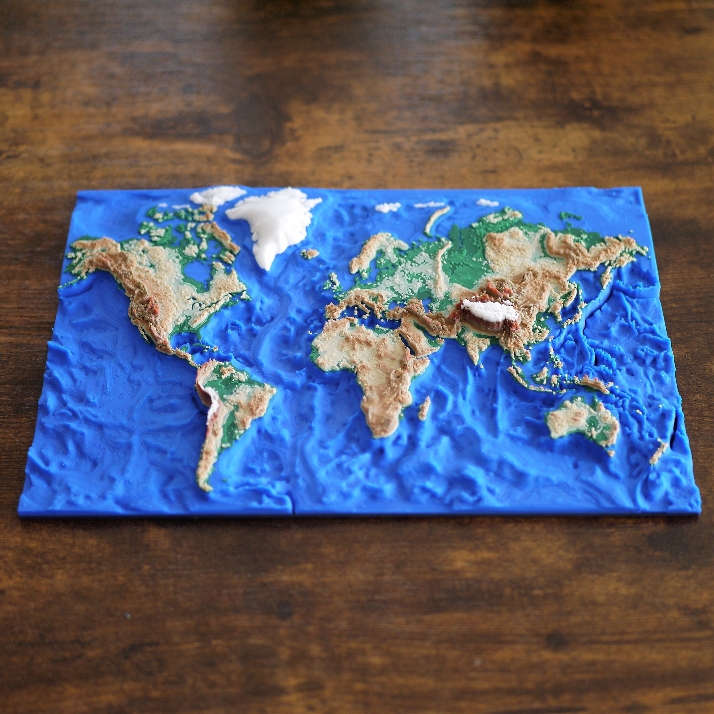
The production was based on the map data of the Geospatial Information Authority of Japan with my own unique adjustments.
Through adjustments I enhanced elevation height than actual data so that you can realize characteristic shape of ground form to understand geographical study.
The colorful model uses 13 different colors of filament!(3D_WorldMap_NoGL.stl & 3D_GreenLand.stl)
<Print Settings>
Top fill pattern:Concentric
3D World Map
by yas · original on Printables ↗
Learning / Other 3D Objects for Learning
♥ 449⬇ 3.2k🖨 8 prints
Print profiles
3D_GreenLand.stl
⏱ time and weight estimated after preparation · 1 material(s)
Made to order: we prepare this file when you order, which adds a few minutes before printing starts.
Prints on: A1 mini 0.4PLA
Order this print
3d_WorldMap_v2.stlDEFAULT
⏱ time and weight estimated after preparation · 1 material(s)
Made to order: we prepare this file when you order, which adds a few minutes before printing starts.
Prints on: A1 mini 0.4PLA
Order this print
3D_WorldMap_NoGL_ver3.stl
⏱ time and weight estimated after preparation · 1 material(s)
Made to order: we prepare this file when you order, which adds a few minutes before printing starts.
Prints on: A1 mini 0.4PLA
Order this print